


-
-
Home
-
- About Upazilla
- Upazila Parishad
- Administration
- Municipality
-
Government Offices
About Human Resources Development
-
□ Upazila Social Services Office
-
□ Upazila Women Affairs Officer\'s Office
-
□Upazila youth development officer\'s office
-
Cooperative Office
-
Upazila Rural Development Office
-
□ National Women Organization
-
□One House One Farm Project
-
□ Upazila Information Center
-
Small Farmer Development Foundation, Upazila Office
-
Polli Darido Bimochon Foundation (Pdbf)
-
□ Upazila Social Services Office
- Other organizations
- e-Services
- Photogallery
-
-
Home
-
-
About Upazilla
Upazilla Introduction
History-Tradition
Geographical and Economic
Public representatives
-
Upazila Parishad
Upzzila Porishod
Chairman office
Upazila Parishad activities information
-
Administration
Upazilla Nirbahi Officer
Office of the UNO
Important information
- Municipality
-
Government Offices
Land affairs
Agriculture and food related
About Human Resources Development
- □ Upazila Social Services Office
- □ Upazila Women Affairs Officer\'s Office
- □Upazila youth development officer\'s office
- Cooperative Office
- Upazila Rural Development Office
- □ National Women Organization
- □One House One Farm Project
- □ Upazila Information Center
- Small Farmer Development Foundation, Upazila Office
- Polli Darido Bimochon Foundation (Pdbf)
Education related
Engineering and communication
Other offices
-
Other organizations
Educational Institution
Private companies
Religious Institution
Projects
-
e-Services
National e-service
Mobile App
Union Information and Services Center
-
Photogallery
Photo Gallery
Video Gallery
Bheramara is known far away as one of the most important upazilas in Bangladesh. Bheramara Upazila Sadar is located 23 km northwest of Kushtia District Sadar. The area of Bheramara Upazila is153.62 square kilometres and 1 lakh 99 thousand 460 people live here.
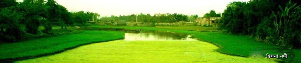
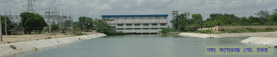
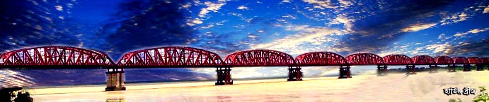
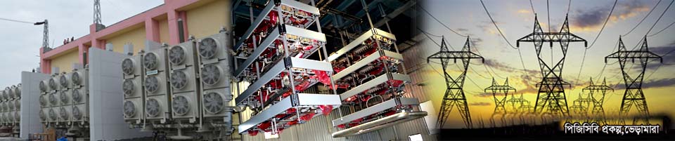
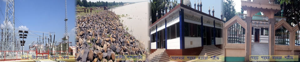
There are two unique beauties 'Hardinge Bridge' and 'Lalanshah Bridge' on the river Padma to the northeast of this upazila. The Upazila is surrounded by Mirpur to the east and south, Daulatpur upazila to the west and Kushtia Sadar upazila to the east. Bheramara Upazila Parishad consists of 1 municipality (Pouroshova) and 6 unions. There are 61 villages and 43 mauzas here. Although Bheramara was previously known as Thana, it was recognized as Bheramara Upazila on 7 November 1971. After Kushtia, the reputation of Bheramara has spread all over the country and the world. It is mostly known for the country's largest Ganga Kopotaksha Irrigation Project, 60 MW power plant, the world's 11th largest and largest railway bridge of Bangladesh 'Hardinge's Bridge' and the country's second largest road bridge 'Lalanshah Bridge'. There is the mausoleum of Hazrat Solaiman Shah Chishti and the three-domed mosque known as 'Ghaibi Mosque'.
The naming history of Bheramara upazila is not known exactly. However, there are many myths popular among the common people in urban and rural areas. It is known that in the past a lot of sheep were reared in Bheramara area. During the British rule, more than a hundred sheep fell under the train and died at the same time in the area adjacent to Bheramara station. At that time, Bheramara was named after the 'death of those sheep'.


Planning and Implementation: Cabinet Division, A2I, BCC, DoICT and BASIS
Technical Assistance:
![]()
Developed By:
